The
Mountains-to-Sea Trail (MST) is North Carolina's epic 1,175-mile trail stretching from Clingmans Dome in the Great Smoky Mountains to Jockey's Ridge on the Outer Banks. And guess what? It passes right through the Triangle. The local sections are wonderful for family day hikes, and walking even a small piece of the MST feels like you're part of something grand.
MST Through the Triangle
The MST enters the Triangle area from the west near Hillsborough and winds east through Durham County, Wake County, and beyond. Key Triangle sections include:
Eno River segment (near Hillsborough/Durham)
Falls Lake Trail (north of Raleigh)
Neuse River segment (east of Raleigh)The trail is blazed with white circles (white dots painted on trees). Follow the white dots and you're on the MST.
Best Family Sections
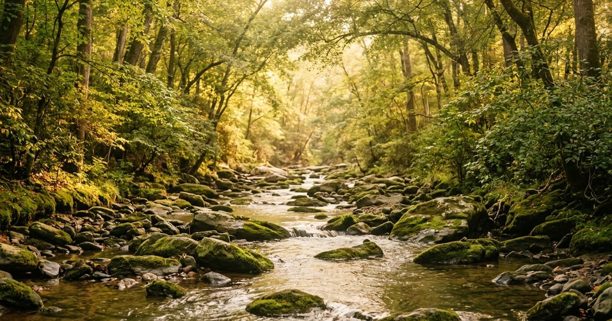
Eno River / Occoneechee Mountain Section
Starting at Occoneechee Mountain State Natural Area in Hillsborough, this section follows the Eno River east. The climb to the Occoneechee Mountain summit (about 0.8 miles) offers one of the best views in the Triangle — a panoramic look over the Eno River valley.
Family highlight: The summit hike is short and rewarding. Pack a snack and enjoy the view.
Difficulty: Moderate (some elevation gain).
Parking: Free at Occoneechee Mountain State Natural Area on Orange Grove Road.
Falls Lake Trail
The Falls Lake Trail is the longest continuous section of the MST in the Triangle, running about 30 miles along the north shore of Falls Lake. You don't need to do 30 miles — short out-and-back hikes work beautifully.
Recommended family sections:
Blue Jay Point County Park to Shinleaf Recreation Area (about 3 miles one way). Blue Jay Point has a nature center, restrooms, and a parking lot, making it a great starting point.
Shinleaf to Rolling View (about 4 miles). More rolling terrain through pine and hardwood forest with occasional lake views.Difficulty: Easy to moderate. Some rolling hills but nothing extreme.
Parking: Free at Blue Jay Point County Park (off Six Forks Road), or at various Falls Lake recreation areas.
Neuse River Section
East of Raleigh, the MST follows the Neuse River. This section is flatter and more remote. It's less well-known than the Falls Lake section, making it a quieter option.
Difficulty: Easy to moderate.
Trail Conditions and What to Expect
The MST in the Triangle is a natural-surface trail. Expect:
Dirt and leaf litter (muddy after rain)
Tree roots and rocks
Creek crossings (some with bridges, some with stepping stones or logs)
Occasional blowdowns (fallen trees across the trail)
Not stroller-friendlyThe trail is generally well-maintained by volunteers from the Friends of the Mountains-to-Sea Trail, but it's more rugged than paved greenways. Wear sturdy shoes with ankle support.
Planning Your Hike
What to Bring
Plenty of water (there are no fountains on the MST)
Snacks and lunch for longer hikes
Trail map (download from the MST website or use the Avenza Maps app with the free MST map)
Bug spray and sunscreen
First aid basics (band-aids, antiseptic, tweezers for ticks)Logistics
Out-and-back hikes are the simplest. Walk in, turn around, walk back.
Point-to-point hikes require a car shuttle (park one car at the end, drive to the start).
Distance planning: Families with young kids should plan about 1 mile per hour. Older kids and teens can manage 2 miles per hour on natural-surface trails.Safety
Tell someone where you're going and when you expect to return.
Stay on the trail. The white circle blazes mark the MST. If you haven't seen a blaze in a while, you may have missed a turn.
Tick checks after every hike. The MST passes through prime tick habitat.
Weather: Check the forecast and start early. Afternoon thunderstorms are common in summer.Making the MST Fun for Kids
Track your miles. Keep a family log of MST sections completed. Over time, you can piece together a long-distance hike one day at a time.
Earn a patch. The Friends of the MST sell section patches that kids can add to a backpack or sash. Completing sections becomes a goal.
Photo journal. Let kids take photos of interesting things they see on the trail: mushrooms, insects, cool rocks, water features.
Tell the story of the trail. The MST was conceived in 1977 and is still being completed by volunteers. Your kids are walking on a trail that people have spent decades building.Quick Reference
| Section | Distance | Difficulty | Parking | Restrooms |
|————-|—————|—————-|————-|—————-|
| Occoneechee Mountain | 0.8 mi to summit | Moderate | Free | Yes |
| Blue Jay Point to Shinleaf | 3 mi one way | Easy-Moderate | Free | Yes (at Blue Jay Point) |
| Shinleaf to Rolling View | 4 mi one way | Moderate | Free | At recreation areas |
Walking the MST is like reading one chapter of an incredible book. Every section tells a different story about North Carolina. Share it with your family.
More Guides You'll Love
[Best Family Hikes Under 2 Miles in the Triangle](/guides/best-family-hikes-under-2-miles-triangle)
[Best Nature Preserves for Kids in the Triangle](/guides/best-nature-preserves-kids-triangle)
[Best Free Outdoor Activities in the Triangle](/guides/best-free-outdoor-activities-triangle)
[Family Guide to the American Tobacco Trail](/guides/family-guide-american-tobacco-trail)
[Free Outdoor Activities in the Triangle (Year-Round)](/guides/free-outdoor-activities-triangle-year-round)